The transformation of the Flat Branch area of downtown into a park is nearly complete, ameliorating the deterioration along the creek that had long been a source of concern for the city.
Historically, many cities have been organized along waterways. While it is certainly no Missouri River, Flat Branch Creek is where our city took root, and it was an important factor in locating the county seat in Columbia in 1821.
While it may be a strange concept to today’s Columbians, who have known it as an ugly drainage ditch, the creek was a boon to the residents who abandoned the nearby town of Smithton, a half-mile to the west, to obtain potable water from a well in the Flat Branch bottoms. The creek also served as a boundary for horse races on Broadway, which an early ordinance only allowed on Saturdays.
1979 drawing of proposed Flat Branch redevelopment, by Maryland consultant Don Zuchelli.
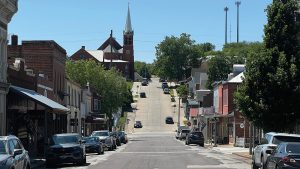
Coming from the north and northwest, Flat Branch drains a substantial portion of central Columbia and provides the majority of the water to the new Flat Branch Park. As Columbia grew in the 19th century, the Flat Branch area served as the city’s hub for transportation and industry. First the Boonslick Trail led settlers into town, and then the Nebo-Neosho Railroad line, which was built in 1868, brought travelers and freight into the Flat Branch area. Its tracks ran down the middle of the wide Waters Street, which was later named “Fourth Street,” and terminated at the Katy Station south of Broadway.
In 1899, the railroad line became a spur of the MKT railroad, bringing passengers and supplies from McBaine to Columbia. The train brought coal for the university power plant and freight for the city and its residents.
I recall unloading city supplies just south of Broadway on a wide blacktop space in the middle of the street. Fuel was transferred into large storage tanks between Fourth Street and Flat Branch and provided cause years later for a major underground cleanup.
The MKT filed to abandon the spur in 1975, ending passenger service to and from McBaine. All service was later abandoned, and the city purchased the railroad land rights.
We tend to forget how important train transportation was in its heyday. Don Faurot once told me that the Mizzou football team used both railroads that served Columbia. He said he had trouble with boys jumping off the train in St. Charles to visit girls at the all-female Lindenwood College.
The Flat Branch area played a significant role in Columbia’s early development. In addition to privately owned land, the area included land that was owned by the city and university in what we would now call a “mixed use” area with limited housing, commercial and industrial applications.
In the 20th century, Flat Branch began to be looked upon as something of a bother. In 1929, Councilman J.W. Bernard, a local florist and chairman of the street committee, proposed a successful motion that a concrete bridge be built over Flat Branch at Ash Street at a cost of about $1,500. Later that same year, a list of the top suggestions for the future offered at a Chamber of Commerce meeting included two people who suggested putting all of Flat Branch Creek under concrete.
The creek section north of Broadway was encased in a concrete culvert in an urban renewal effort during the 1960s, leaving the section south of Broadway open, which collected spilled concrete, litter and much junk. On a brighter note, I recall a young child rescued from the open creek south of Broadway during a storm after being washed into the box culvert at the open end to the northeast and traveling for many blocks.
By the 1950s, the area was showing signs of wear. In ensuing decades, new plans to revitalize the Flat Branch area would come and go every few years, but they would run aground over property rights issues and business interests, with public defeats at the ballot box.
In 1958, a survey indicated that 91 percent of Columbians favored the building of a civic center, and soon plans were launched to build an auditorium that could function as a basketball court, convention center and concert hall. Four years later, architect James Darrough was chosen to design the building with a seating capacity of 2,600, but voters defeated the $1.25 million bond issue.
In the early 1960s, the Land Clearance for Redevelopment Authority (LCRA) presented a second urban renewal plan to the city council that included a large part of central Columbia’s college and university areas along with the Flat Branch area. Slum housing was located on both sides of the Flat Branch south of Broadway, most on what was termed “Cemetery Hill” west of Providence. Earlier, the LCRA cleared a substantial area north of Broadway, encased Flat Branch in concrete, and launched redevelopment efforts including new housing under the Housing Authority. These improvements occurred under the leadership of LCRA Chairman B.D. Simon, a major contractor.
An aerial view of the redevelopment plans proposed by Zuchelli, Hunter & Associates in 1979.
However, property ownership and occupancy were fairly debated on the second issue, which in 1963 failed on a vote of 4,579 to 3,183. Opponents included A.J. McRoberts and attorneys Ralph Alexander and Edgar Wayland.
Shortly after the defeat of the second urban renewal issue, which included the Flat Branch area, the city council directed that “slum areas and housing” be cleaned up. One area included dilapidated homes on Cemetery Hill and eastward to the east side of Flat Branch Creek. The occupants owned few of the houses, and Edgar Wayland was attempting to purchase the property for commercial use on Cemetery Hill from landlords.
I recall our only building inspector, Albert Richardson, and I, as public works director, inspecting each house and posting it as unsafe. Under the ordinance, I conducted public hearings for owners and tenants who were relocated primarily in newer housing provided by the housing authority. It was an awesome task. Although the homes did have electricity, living conditions were awful, similar to the third world, with common outside watering points, outdoor privies, gravel and dirt roads and unbelievably poor housing.
Cemetery Hill was cleared, and Wayland finally got all the land purchased to build the shopping area that once held Osco Drug and now houses such stores as Office Depot. Some of the property to the south remained vacant. I recall Wayland telling me it had been a mistake to lead opposition to the urban renewal vote because it was almost impossible to negotiate for all the property that LCRA could purchase by eminent domain if necessary.
In June 1966, a study by the Beverly Hills consulting firm Space Utilization Associates (SUA) recommended a new City Hall and Civic Center in the area surrounded by Broadway, Locust, Providence and Fifth Street. However, this plan was not pursued, and in 1972 the city and county partnered to purchase the Daniel Boone Hotel from Jim Nanson following a major fire in the building.
The City Council in 1968 approved an ordinance authorizing the city to apply for a federal Housing and Urban Development grant of $187,000 to plan the rehabilitation of the Flat Branch area. The urban renewal project took over a decade to develop, with the council approving official boundaries for the Flat Branch development project in 1978. The area included 33 acres bounded by Providence Road, Broadway, Elm Street and Fifth and Sixth Streets. In addition to the city and MU, there were 44 other private owners of parcels of the Flat Branch land.
During this time, some business growth continued in the area. The Katy Station Restaurant opened in 1976, for instance, Hardee’s purchased its 1.6-acre lot bordering Providence Road in 1978, and a new office building was constructed.
The council voted to draw up a proposal and hired Annapolis, Md., consultant Don Zuchelli, who presented designs for the potential Flat Branch development in 1979. By 1980, the urban renewal project for the Flat Branch area evolved into a multi-use complex that would include a $3 million civic center, convention center and 225-room hotel.
Catalysts for the new effort were former mayor Bob Pugh, the new LCRA chairman, and architect Jack Cooper. Mayor Les Procter appointed the LCRA members who would create the plan. Vice Chairman Mark Landrum, a community leader, president of First National Bank and a former chair of the Special Business District, emerged as one of the project’s most vocal supporters. MU Chancellor Barbara Uehling and University of Missouri System President James Olson held many discussions. However, voters defeated the $31.5 million proposal by a two-to-one margin in April. Once again, A.J. McRoberts led the successful opposition, and attorney Dave Bear represented the property owners. Local Attorney Edgar Wayland was one supporter of the new plan who had stood against the 1962 proposal.
Flat Branch Park during recent renovations.
The vote was just another in the pattern that had developed over time. Interested citizens would bring forth ideas, plans would be developed to implement them, but the public would vote them down. Usually, the ballot measures would stumble over issues related to land and business ownership.
After decades of challenges for improvements, a vision for the “Flat Branch Area” and the southwest sector is under way and continuing. The city, university and other entities have developed partnerships to make improvements to the area that will be good for the Flat Branch area, downtown, the university and our entire community, which I will discuss further in part two.