East Columbias growth guidelines
Council considers staff plan before making major development decision
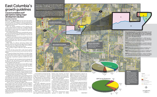
Click to see full spread
This is the big picture
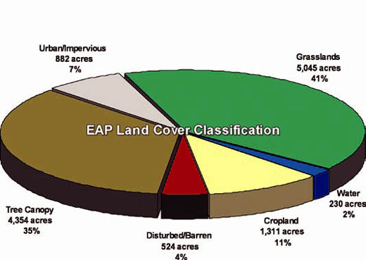
the City Council will examine next month: a guidebook prepared by city and county planners for future growth in east Columbia, an area spreading across 21 square miles south of Interstate 70 and east of US Highway 63 that is largely undeveloped.
This is the practical application of those guidelines that Council members will face a week later: a request by Richland Road Properties to annex and rezone 271 acres of Boone County land within the study area that’s now designated for agriculture use and single-family housing.
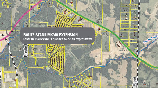
The developers want permission to eventually build commercial centers and relatively dense residential areas in a section near the approved route for a highway connecting I-70 and the east end of Stadium Boulevard.
If approved, and if proposed roads are actually built, the land could be developed into hundreds of thousands of square feet of office and retail space and a maximum of 1,000 dwelling units, mostly single-family houses with some allowances for condos and apartments
Robert Hollis, the attorney representing Richland Road Properties, said if the City Council once again declines to approve their request, the five contiguous tracts might end up being parceled into smaller areas and developed piecemeal.
“We are trying to engage in large-scale, long-term planning,” Hollis said.
So is the city and county, which is why Council members voted in July to put off their decision until the East Area Plan was finished.
The request by Richland Road Properties to develop its large tract of land will be the first of many to come as the city expands to the east and the Council is called on to manage growth using the long-range, comprehensive guidelines drafted by the urban planners.
Patrick Zenner, the city’s development services manager, said the East Area Plan was produced to provide guidance for the development community and residents as to what may or may not be acceptable in this entire area. .
“Not often has this community seen an active effort to engage two political entities on a single common activity that will define its development destiny,” Zenner wrote in an e-mail, “much less engage the public so robustly in that activity.”
It was not, he stressed, commissioned just to help determine the fate of the Richland Road Properties case.
Developer David Atkins first filed the annexation and rezoning petition in November 2008, and the company modified the proposal before and after the City Planning and Zoning Commission recommended denial of the project in October 2009.
In opposing the development plan, the city staff and the P&Z Commission cited concerns that the proposal was predicated on road construction that remains uncertain, included density too great and placed commercial property in inappropriate locations. Overall, the opponents said the request was premature and set a bad example for future long-range planning efforts.
“We’re not here to make life more difficult; rather, we’re trying to anticipate what is most necessary to sustain the quality of life that attracts many to this community,” Zenner said. “Without sound planning policies regarding development, which this plan offers, we stand to lose a whole lot more.”
Mayor Bob McDavid and the majority of the Council, which has become more development-friendly since the plan was rejected, supported the production of the long-range plan but insisted that Richland Road Properties deserved to have its request voted up or down by Oct. 18.
So the timetable for the East Area Plan was moved up in time for the city and county P&Z commissions to consider the draft document in a joint meeting on Sept. 30 and for the City Council to check it out during an Oct. 11 pre-Council meeting before it comes up for a public hearing and a vote.
The study, a collaboration of city and county planners with area residents and other stakeholders, covers land use, environmental concerns, utility coverage and infrastructure. They held five public meetings and summarized the sentiments.
Residents of neighboring properties who expressed their views largely spoke against the land use proposed by Richland Road Properties and feared dense development, an increase in crime and a loss of aesthetic value, among other changes. Many are apprehensive about the loss of their rural lifestyle.
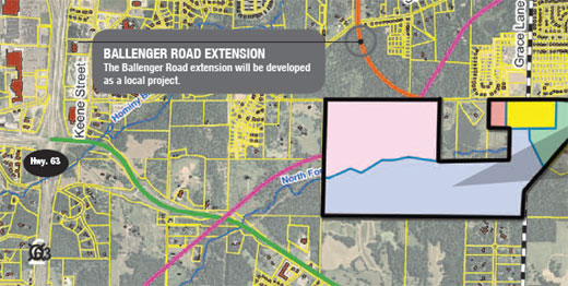
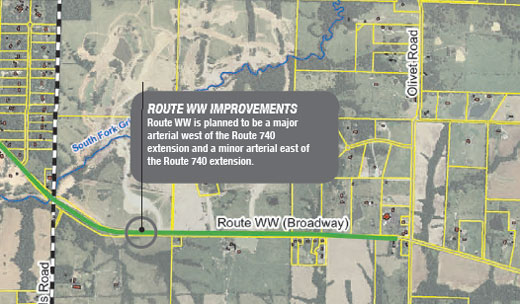
However, Hollis pointed out that the rezoning request is not the blueprint for a series of office buildings or a strip mall but merely a request for permission to build those things. Construction on the property in question is dependent on the proposed extensions of Stadium/740 to the northeast Rolling Hills Road, north of Route WW to Richland Road, and Grace Lane to I-70.
The federal Environmental Impact Statement is finished, the Federal Highway Administration approved the highway route in June, and on Sept. 1 the Missouri Highways and Transportation Commission gave its approval, though it noted that there is no funding available to actually build the highway in the foreseeable future.
The development agreement attached to the request says development is limited to “that which is supported by sufficient roadways and infrastructure.” Hollis previously pointed out that “all infrastructure is available to this site except adequate roadways,” a position backed in the East Area Plan.
In other words, if the project is approved, bulldozers won’t roll in the next day. Years might pass before a shovel is turned on the land.
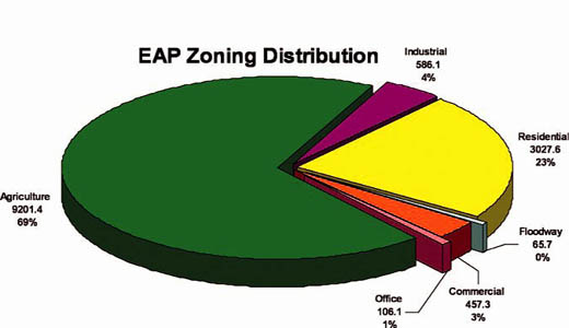
The East Area Plan is in draft form, but it does not bode well for the rezoning request. The draft plan recommends that the 271-acre tract be zoned residential.
Zenner said after hearing public comments against more commercial development, the planning commissions looked into the area’s needs more closely.
“We wanted to look at why the public didn’t want to have any more commercial (development),” Zenner said.
The summary includes a recommendation that “no new ‘regional commercial’ development is necessary within the study area based on the findings that there exists an ample supply of existing, planned and underdeveloped commercial property in or within five miles of the existing residentially developed areas.”
“About everything’s within five miles of every type of existing or planned commercial you’d ever need,” Zenner said, citing the existing commercial areas at Highway 63 and Stadium and St. Charles Road, as well as the undeveloped commercial areas at Gans Road and Discovery Parkway.
But the draft plan also recommended that “new ‘neighborhood marketplace’ nodes may be supportable in locations where future residential development will be proposed, provided that sufficient infrastructure and population density are in place to support 50 percent of the proposed square footage at the time of zoning.”

Land use
