When Dave Griggs was a child, his family lived along Highway 63, about a mile north of the 63 Diner. He attended a one-room country school. He had the same teacher for all eight years. And of the 100 or so daily cars that typically would travel Highway 63 in those days, he’d know who was driving eight out 10 of them.Prior to that, his family lived in the second house west of West Boulevard on Broadway. They would wash their car in the small creek at the bottom of that hill.
“Can you imagine someone doing that now?” he muses. “And just think of what’s happened on the north side of town.”
In his adult life, Griggs has sat on six or seven transportation-related boards and committees, three of them related to Interstate 70 alone. He’s a lifelong Boone County resident who can talk for hours about Columbia’s historic growth patters and spout off fact after fact: More than 60 percent of the U.S. population lives within 500 miles of Columbia. That jumps to 80 percent at 800 miles, he says. But more importantly, he sees the important role transportation infrastructure plays in the success of our city.
“It’s not just getting from the north side of town to the south side of town or from Columbia to Jefferson City,” he says. “[Transportation infrastructure] is a key economic asset. We’re both cursed and blessed by our location in the U.S., at the crossroads of major north and south and east and west traffic.”
What’s CATSO?
Griggs spent one and a half years on the Columbia Area Transportation Study Organization, or CATSO, while serving as county commissioner.
Created in 1964 by the governor of Missouri, CATSO became responsible for “ensuring a coordinated transportation process” within the Columbia metropolitan area, according to Trent Brooks, an area engineer for the Missouri Department of Transportation.
CATSO includes both a technical committee comprised of planners, engineers and other transportation professionals and a coordinating committee, or policy-making committee, of upper-level city and county staff members and representatives from a variety of other transportation entities, including MoDOT.
The group meets quarterly and must prepare a long-range transportation planning document every five years. The next plan, for 2045, is scheduled for completion by February 2019, according to Mitch Skov. The senior planner works in the planning division of Columbia’s Community Development Department. His office on the fifth floor of City Hall is covered with poster-sized maps and 12-inch piles of traffic reports.
Skov has worked on these sorts of projects for more than 25 years. The most recent plan, for the year 2040, was his fourth and provides recommendations on all forms of transportation in the Columbia metropolitan planning area, including estimated costs of all projects it recommends as well as projected revenues available by that date for each of the involved jurisdictions. However, the plan includes many projects for which no funding has been reserved. These plans have set the right of way for many of Columbia’s most traveled roads: for example, the transition of a two-lane country road into Grindstone Parkway.
A leader of development
Where CATSO’s plan really comes in handy is providing a projection of future growth — and, if that growth occurs as planned, a way to connect it to existing infrastructure. These future growth projections are informed by a number of things, not the least of which are sewer and water lines.
“If you don’t have good sewer and water infrastructure, you aren’t going to have the subdivision,” Griggs says. “If you don’t have the subdivision, you won’t have the people. If you don’t have the people, you don’t need the streets.”
“I think most people would recognize we haven’t done a great job keeping up with our infrastructure needs,” he says.
“The dollars we spend today on new infrastructure should be based on where that growth is going to be,” Griggs adds. “It’s hard to say what gets the cart in front of the horse, but basically it’s CATSO’s job to figure out where that growth is going to be and figure out the right of way so when property is developed, the right of way is preserved, and those streets are developed.
“So CATSO, in essence, really does drive development.”
As with any good plan, CATSO’s long-term plans must also be subject to change. To illustrate this point, Griggs mentions Old Hawthorn, “which, truly, until eight or nine years ago was a farm.”
“There was no dream,” he says. “Maybe Mr. Sapp someday had the vision of building a golf course and a community out there, but as far as on the radar for traffic flow problems, there was nothing there.”
Another example, he says, is the selection of a location for a school.
“When a school system is looking to locate a new school and picks a pasture off of St. Charles Road, it completely and very quickly changes the dynamic of infrastructure needs,” he says. “Until the high school came into the picture, it was just a little two-lane, hardly paved country road. Now it will need to be a pretty significant arterial street. And how do you get the right of way to do that? How do you eliminate the curves in the road? How do you get it above the floodplain there by the golf course?”
“You can plan the best you can, but you can’t anticipate things like that,” Griggs says.
Drawing lines
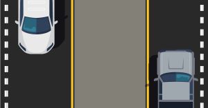
Ultimately, CATSO provides an outlet for discussion by various entities that play a part in traffic management, which has a lot of solid yellow lines and “Do not enter” signs.
For example, most people might not know that MoDOT manages Providence, Stadium and College Avenue or that I-70 and Highway 63 are federal highways, according to Brooks with MoDOT.
“Most roads are the responsibility of one jurisdiction,” Brooks says. However, there are some roads that are shared. Some are even split into two jurisdictions by the road’s centerline. Brooks says most of those shared roads are in the peripheral area around Columbia.
“If a curb sign was knocked down on the city’s side of the road, the city would fix it,” Scott Bitterman says. “If it’s not in the city, the county would take care of it. If it’s something that requires both sides of the road, like a new asphalt surface, we would look at the percentages of the roadway in the city and county and work out a cost-share agreement.”
Although Bitterman now works as the city’s supervising engineer, he got his start with MoDOT.
“I was the guy with the ‘Stop’ and ‘Slow’ signs,” he says.
Then, he went to college to become and engineer and found he really enjoyed roadwork. The street division employs between 50 and 60 people, including garage custodians, meter technicians, parking enforcement agents, traffic engineers and more.
“Basically, anything to do with streets is our job,” Bitterman says.
When it comes to roads such as Providence — state roads running right through Columbia — things are a little less cut and dry. For example, state roads such as Providence that cross Columbia city streets, require coordination. One computer runs each intersection; so for instance, at College Avenue and Walnut, MoDOT maintains that computer and signal.
“Usually the intersection is maintained by whichever jurisdiction’s road carries more traffic through that intersection,” Bitterman says.
‘Problem’ areas
Bitterman would be among the first to admit what most Columbians already know: some of Columbia’s intersections need work. Stadium and Providence, despite current plans to extend a southbound to westbound right turn lane, is among the first to come to mind.
Another problem area?
“Fairview and Worley,” Bitterman says. That’s back behind the Columbia Mall; it’s two T intersections. “If you hit that at the wrong time of day, you’ll be sitting there for a long time.”
Although Bitterman and his co-worker, traffic engineer Lee White, can point out many areas that need work, he’s more hesitant to point out areas of success.
“We’re engineers,” White says. “We optimize. It’s just what we do.”
“Each intersection is different, and each intersection has its problems,” he adds, but he wraps up with a true engineer’s answer. “All problems have a solution; it’s just a matter of getting to them.”
Sgt. Curtis Perkins, who heads up the Columbia Police Department’s traffic unit, says the area he considers the most improved is where Stadium crosses I-70. He says the most problematic area now is the 70-63 interchange. According to Bitterman, the 63 Connector is the only U.S. Highway interchange to an interstate in Missouri that is still controlled with traffic signals.
“Can the 63 Connector be fixed?” Perkins asks. “Yes, but at what cost? Ultimately, road improvements come down to one thing: money.”
Progressing the plan
Some of the plans, like the extension of Stadium beyond Highway 63 and looping back to I-70, have been on numerous long-term plans and remain incomplete.
“It’s so expensive,” Griggs says, gently shaking his head. “It’s not feasible.”
He folds his arms and leans forward.
“Government has a great way of kicking the can down the road, and the federal government has the best punters,” he says.
Griggs attributes MoDOT’s improvements over the past few years to money that was generated by a bonding program passed in 2008. “If they have enough money to maintain the roads they’ve built now, it will be a miracle in my humble opinion.”
“The CATSO plans are going to be followed,” Griggs says, “but it’s going to be more in pieces than it has been because of lack of funding.” Those bits and pieces, he says, will be driven by developers’ plans.
“If there’s a street put in a subdivision, the developer paid for that street,” Griggs says. “The reason Providence Road is in sections on the north side of town is because the city required the developer to build that section of the street as part of his development cost.”
“I think some members of City Council don’t think developers pay for those things,” he adds.
In the case that the developer’s construction project was something the city was already planning to do, Wes Bolton, a traffic consultant with Allstate Consultants, says the developer and the city come up with a plan to both pay in.
“If the city was planning to fix this, and the developer was required to do something, then we may have the money to implement the ultimate scenario right off the bat,” Bolton says.
Sometimes even the developer doesn’t have the money to make the transportation changes it needs. For example, the transportation development district by Conley has already designed and bid a project to connect Business Loop 70 and Conley Road, “but the bids come back higher than the funds they’ve got to do it.”
No money, no roads.
Traffic management
Lee White is probably one of only a few people who smiles when he talks about traffic. He just might be the only person to excitedly ask if he can tell you more about “yellow and all-red,” when, after a traffic signal turns from yellow to red, all signals remain red for a few seconds to minimize traffic accidents in the event that someone does run a yellow light as it turns red.
He’s also very patient and takes the time to fully explain HAWK beacons (High–Intensity Activated crossWalK). It’s basically a seven-step pedestrian crosswalk system, similar but more intense than the one by Broadway and Waugh. Two HAWK beacons are to be placed on College Avenue, one between Rosemary and Wilson, the other between Bouchelle and Ross.
In addition to reviewing construction and development plans and analyzing traffic impact studies, White implements new technology to handle traffic concerns. It’s his job to find yellow and all-red and HAWK beacons — and traffic, in general — fascinating.
Although most of Columbia’s lights have detectors, one of the newest technologies has been the use of adaptive signals. Typical detectors are all or nothing, meaning, if there is one car waiting, for example, to turn left, the detectors knows it, and the car will get a green arrow on its next turn. With adaptive technology, that single car turning left might get skipped once or twice while the light serves higher-demand paths. If you frequently drive Grindstone, this is something you’ve likely experienced. Scott Boulevard, Chapel Hill and the lights by the Columbia Mall also have adaptive sensors, and a handful more were added to Stadium in February.
“It’s just a matter of funding them,” White adds. Only a handful of lights have adaptive signals, but most lights have some form of detectors—except downtown.
“An older signal, like the ones downtown where traffic patterns have been established for decades, they don’t have sensors,” he says. Downtown also has the added element of high pedestrian traffic, which isn’t conducive to sensors.
“Just because there are not vehicles doesn’t mean there are no pedestrians,” Bitterman says.
Columbia already has coordinated lights “everywhere we can,” White says, which allow cars to move through multiple green lights in a row. To make sure the lights are timed appropriately in the first place, White has a grueling task: traffic counts at each intersection to determine how many people are going each direction through the intersection at different times of day.
He tries to conduct 12-hour traffic counts, which he splits with Chris Valleroy, a senior engineering technician.
“It’s tough,” he says. “I counted Broadway, which sees more than 30,000 vehicles in a day. And I had to count them — for 12 hours.” That’s not including the pedestrians, which he also needs to count.
Construction from A to Z
Because development trends drive road construction, local traffic and roadway jurisdictions must work very closely with private industry. According to Bitterman, the city works with a variety of consultants, many from Columbia, others from St. Louis and Kansas City and a parking consulting firm in Chicago.
Bolton says they work both on projects for municipalities, such as the City of Columbia, or act as staff engineers for smaller municipalities, including Ashland, Chillicothe and New Bloomfield, in addition to the work they do with private organizations.
“We get approached by someone developing a tract of land, and we work with them to figure out the best way to provide them with transportation infrastructure,” Bolton says. “We’re kind of the intermediary between the city and the developer.”
Traffic studies are done by a third party, such as Allstate, and then reviewed by the city or whichever jurisdiction the development will be located in.
Suspected traffic implications — often correlated with size — are what best determine whether a traffic study will need to be completed. White says in a busy month the department might get three projects that require a study, but Bolton says not all developments need one.
“Sometimes a traffic professional can determine that a development won’t have a huge impact,” he says. “For example, a drive-thru bank or a fast-food restaurant will produce a really high amount of traffic, while an office building sometimes doesn’t.”
For those fast-food restaurants, banks and other high-traffic developments, Bolton says his job often includes explaining how roadway configuration can impact business.
“If you want to get Chinese food in a development, and you have to sit at a light for 45 seconds and then weave in and out of 17 stores, you’re probably just going to go somewhere else,” he says. “Sometimes a developer may not want to do any traffic improvements even though it would be best for their development.”
Sometimes, he says, a developer will have a layout in place that works well for the development but is poorly configured for transportation. In some of those cases, Bolton says his hands are tied; there’s not much he can do to improve traffic flow if the developer is set on a certain configuration, and the city approves it.
Everyone’s an expert
When Bolton talks about roundabouts and other traffic measures, he uses the word “nerdy” often. He can easily list off favorite projects and explain any road construction-related question. Those short curbs at the signal at Brickton and Trimble? They’re called “truck aprons” and provide semi-trucks more room to maneuver the turns.
What originally drew Bolton to a career in traffic consulting is a little less scientific.
“Most engineering is very inside the box: A steel beam is a steel beam; it doesn’t have a mind of its own,” he says. “But human beings control traffic, and they’re going to do what they’re going to do.”
And because everyone drives, traffic engineering has another specificity: a high level of scrutiny.
“No one sits in a storm pipe thinking of ways to improve it,” Bolton says. “You just tell them how you’re going to fix the pipe, and they believe you. Everybody drives, so everyone thinks they understand traffic considerations.”
“We’ll turn in a traffic study that shows a development will have minor impacts on traffic or that improvements won’t be necessary for 30 years, but then someone just won’t believe you,” Bolton adds. “I’ve been in public meetings where a consultant we work with gave this great presentation, and at the end of it, during public comment time, someone stood up and said, ‘I drive that every day, and I think you’re wrong.’”
Griggs agrees; it’s certainly not easy to understand traffic. In fact, he says for the first year he sat on CATSO, he was “pretty useless.”
“You really have to understand the history and the science of traffic studies, which sometimes totally contradicts what I think is common sense or what’s obvious,” he says.
Logically, he says, an I-70 bypass would get traffic off the existing I-70 ramp and improve safety and traffic flow for Columbia citizens. But when some “very, very smart people with very, very smart computer programs” began studying the patterns, Griggs says, they discovered it would be a pointless improvement.
“About 60 percent of traffic that goes past the intersection of Providence Road and I-70 stops in Columbia…” he says. “It might be to get a cup of coffee or to get gas. It might be a salesman stopping for the night to make 15 calls. Maybe I’m a driver making a delivery to one of the freight terminals here or picking up freight from, say, MidwayUSA, Dungarees, Columbia Foods or Quaker Oats.”
“In reality, a bypass probably wouldn’t relieve any congestion because people are going to stop here anyway.”
“I think some people don’t realize the science that goes into everything behind traffic,” Bolton says. “And I get it because sometimes it just doesn’t make sense, but there’s a reason behind those traffic plans.”