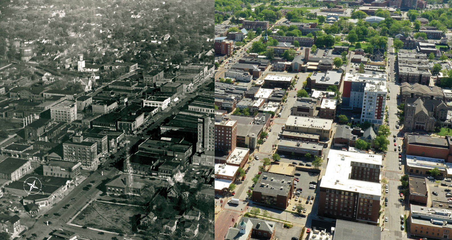
Downtown Columbia, Circa 1925-1933.
(Roe F. Montgomery Scrapbook. P0054. 023140-2. The State Historical Society of Missouri. Photograph Collection.)
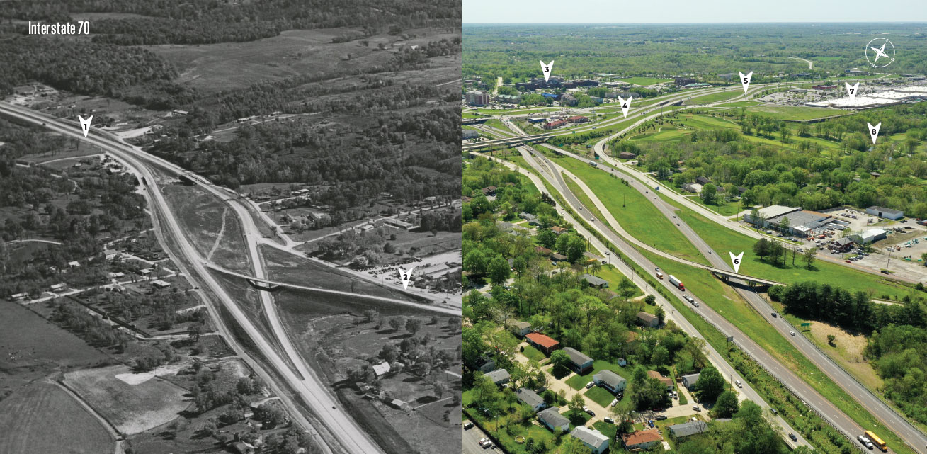
Interstate 70, 1960. (Missouri Ruralist Photographs. P0030-4800. The State Historical Society of Missouri. Photograph Collection)
1. I-70
2. Business Loop
3. MU Women’s and Children’s Hospital
4. Highway 63
5. Conley Road
6. Exit 128
7. Walmart Supercenter
8. Columbia Country Club
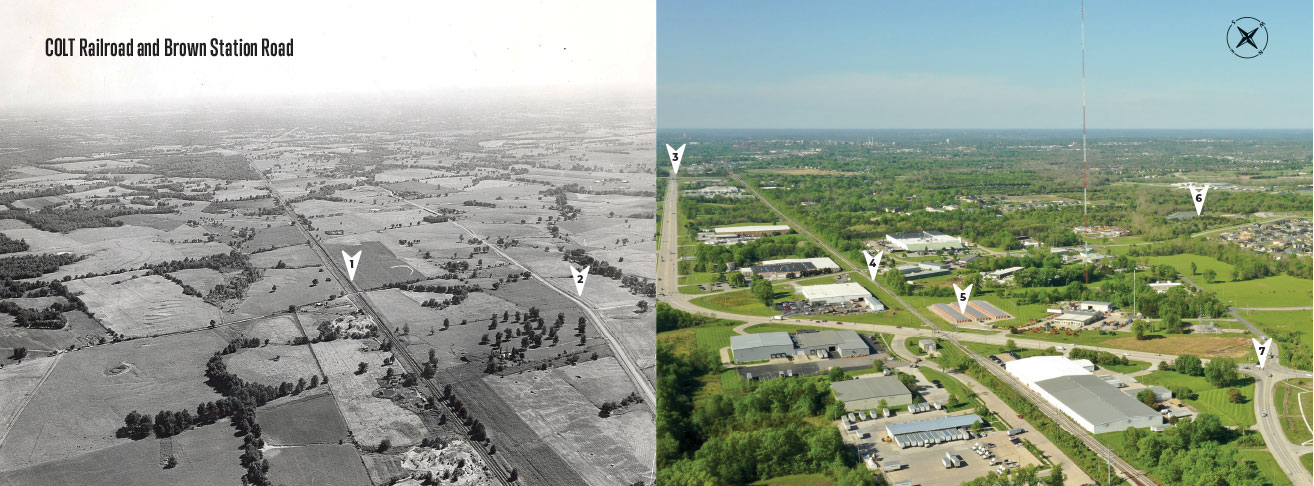
Industrial Development Site, Looking South, Circa 1955. (Image used with permission from the Columbia Missourian.)
1. COLT Railroad
2. Brown Station Road
3. US Hwy 63
4. COLT Railroad
5. 10 Federal Self Storage
6. Norma Sutherland Smith Park
7. Intersection of Brown Station Road and N Rte. B
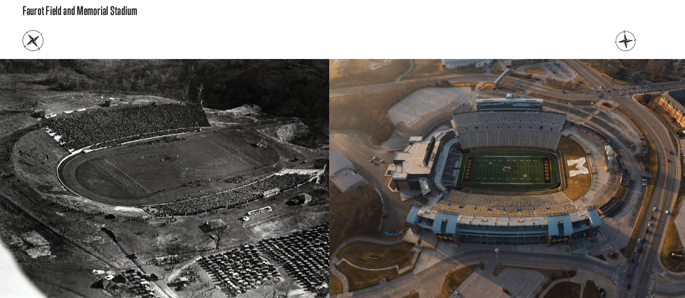
Memorial Stadium, 1928. (Roe F. Montgomery Scrapbook. P0054. 004886. The State Historical Society of Missouri, Photograph Collection.)
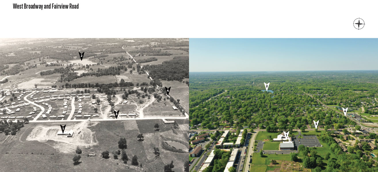
Leawood Subdivision, 1959. (Copyright Charles Mar Pictures. P0078. 019428. The State Historical Society of Missouri. Photograph Collection.)
1. Broadway Christian Church
2. Hulen Lake
3. West Broadway
4. Fairview Road