Kathy and Ken Davis put a “For Sale” sign on their rural property at the intersection of St. Charles Road and Route Z after hearing about the plan for building a new high school nearby.
The 18 acres they bought 20 years ago was once part of a bustling village known as Shaw, where the road linking Centralia and Jefferson City met the Boone’s Lick Trail. Travelers were served by a livery stable and a blacksmith shop on the Davis property and a general store across the road, but Shaw gradually died out in the 1900s as cars became the transportation of choice.
The couple still keeps a few horses in the stable, but their faded red shed is now used for a vegetable stand that not many people drive by these days.
The appraised value of their land is $27,300, or about $1,475 an acre, not counting the buildings.
However, the high school construction on St. Charles Road and related road and sewer improvements will make the area northeast of Columbia a magnet for development. Now, the Davis land is going for $20,000 an acre.
Property along Route Z from St. Charles to Interstate 70 could see the most dramatic value increases because of the new high school, Boone County Assessor Tom Schauwecker said.
“When the school is open, when the sewer is in place and the access is suitable for the traffic, it will take off,” Schauwecker said.
Kathy Davis said she’s counting on the land sale to help pay for her retirement. “Let it develop,” she said. “I’m ready to sell.”
The city, county and school district held a groundbreaking ceremony at the high school site on July 15, and construction is scheduled to be finished in time for the school year beginning in August 2013.
The land around the school’s site on St. Charles Road, between the Lake of the Woods golf course and Route Z, looks similar to the land along South Providence Road before Rock Bridge High School was built in 1973.
“I can’t help but think 40 years ago today we weren’t in a similar situation with Rock Bridge High School,” Superintendant Chris Belcher said during the ceremony. “Out in the middle of a bean field, being criticized for being in the middle of nowhere to build an almost 300,000-square-foot high school.”
To get an idea about how a high school affects development, look at South Providence now: State Farm is across the road from the high school; the Corporate Lake commercial development and the Peachtree shopping area are on the flanks; and residential neighborhoods are behind the school as far as the eye can see.
Dozens of school officials, several politicians and a few developers were among the more than 70 guests attending the ceremony at the site of the new school, an 80-acre overgrown pasture with a few tree stands. Workers recently demolished the farm buildings and are now leveling the land.
A cornfield in the distance is part of the acreage owned by a partnership that includes Tom and Scott Atkins, Bob Pugh, Rob Wolverton and the Lemone family. Their company, St. Charles Road Development, sold the 80-acre site to the school district in 2007. They bought that tract along with 156 acres of farmland to the north and west of the site in 2004.
The school district is in the process of purchasing an additional 4.2 acres from the St. Charles Road Development at the rate of $11,250 per acre, school spokeswoman Michelle Baumstark wrote in an e-mail.
The school needed the extra space, she said, to meet new state and the county requirements, including storm water retention, and to provide adequate space for athletic fields.
Directly across St. Charles Road from the school property is the Golf View subdivision. The collection of duplexes gets its name from its neighbor to the west, the Lake of the Woods golf course.
The only other residential development near the school site is Copper Creek, a subdivision with single-family homes on the site’s eastern border.
ABC Laboratories, which is undergoing a $4.2 million expansion, is located on an outer road between Interstate 70 and the school site, and the Fabick CAT construction equipment company and the Loveall RVs lot are nearby.
In three years, approximately 1,700 students, along with 200 teachers and other school employees, will start driving past those subdivisions and commercial sites.
Although voters passed a school bond issue in April that will be used to pay for the $75 million school construction, the city and county began preparing for the school’s impact on development after the site was chosen in 2007.
A city-county commission came up with the Northeast Columbia Area Plan after a series of public hearings and strategy sessions. (The boundaries of the targeted area are Lake of the Woods Road to the west, Mexico Gravel Road to the north, Route Z to the east and I-70 to the south.) The commission decided the area, which covers five square miles and 3,100 acres, needed better roads and improved electric and sewer service.

Is the infrastructure adequate?
The electric system has been improved to handle the school’s power load, and the city expects to finish a sewer trunk line extension to the school property along the north fork of Grindstone Creek by this time next year.
Road improvements won’t come as fast.
The NECAP called St. Charles Road “particularly unsafe,” and the Route Z overpass at I-70 is in “poor condition for accommodating the current traffic pattern.” The plan and a traffic study determined that many intersections couldn’t handle additional school traffic efficiently if they are not improved. However, an upgrade of St. Charles Road from Route Z to Lake of the Woods is on hold, with no funding allocated and no projected start date. The city’s long-term road construction plan calls for the $20 million upgrade to be finished before 2030. Nothing is in the works to improve the Route Z overpass.
City Planning and Development Director Tim Teddy said the St. Charles Road upgrade could become a bigger priority once the high school and other development comes along.
“Where a need doesn’t exist, public authorities around here don’t make improvements,” he said, “but … a demonstrated need will demand some response.”
Yonke said something has to be done about intersections that the traffic study identified, such as Route Z and St. Charles Road.
If the school were a private development, Yonke said, the owners would have to pay for all these needed improvements, do the work and open only after the upgrades were complete.
Upgrading a road isn’t the only way to make it safer, Teddy said. Adding the planned roads to the area should take demand off St. Charles Road.
“As the road system northeast of I-70 fills with those collector streets, you can divert some traffic from St. Charles Road,” he said.
The Columbia City Council approved the NECAP plan in December, and Northern Boone County Commissioner Skip Elkin said the County Commission will vote on the plan in the fall.
The housing market rules
During the city’s public hearings, residents in the study area said they know development is inevitable but want to maintain some of the rural character. Because developers follow the desires of the market — people who want to live or set up shop in the area — it will be up to City Council members and county commissioners to decide how much of the country atmosphere is preserved.
“The challenge of being a good and responsible developer,” Rob Wolverton said, “is to balance what the market is asking for with what the government entities and the rest of the surrounding neighborhoods are asking for.”
Wolverton, president of R. Anthony Development, said builders have to do what the buyers want. It’s this demand that will determine what he and his partners put on their remaining land around the school.
Even before the high school site was picked, the land, valued around $520 an acre because of its agriculture classification, was an attractive investment because of nearby amenities such as the golf course, Wolverton said.
“We felt like it was an area where the cost of the land versus the quality of the land and the surroundings meant our best value was in that part of town,” he said.
In 2007, their company sold the 80-acre site to Columbia Public Schools for about $900,000, or $11,250 an acre. (In 2006, all 236 acres were used as collateral for a $3 million loan from Boone County National Bank.)
Another attractive feature, Wolverton said, is Copper Creek. The development’s large, single-family homes appraise for an average of about $242,000. The Golf View development, owned by Knor Holdings, generally has lower appraised values than Copper Creek, with houses ranging from $90,000 to more than $200,000, according to the Boone County assessor.
Mike McClung and his brother own Copper Creek and about 65.5 acres north of the subdivision. This land remains undeveloped because of the downturn in the housing market, McClung said. The appraisal for the two parcels averages about $425 an acre.
(A Missouri constitutional amendment in 1982 created a favorable property tax status for farmland, Schauwecker said. By law, soil quality determines agricultural land value, not fair market considerations. He said this explains why the county’s appraised value for a property and its fair market value can vary widely. As a result of the law, he said Missouri has one of the lowest tax rates on agricultural land in the nation.)
Commercial development
Although the area around the school is rural and residential, there’s a pocket of commercial development around the Route Z access to the interstate highway.
The Columbia Area Jobs Foundation and Regional Economic Development Inc. are developing an industrial park on Route Z a half-mile north of the exit. The foundation already owns 20 acres, which went on the market in April, and has agreements in place to buy 140 more if a potential industrial employer needs additional space. The foundation, a quasi-governmental body, bought this land using a $200,000 loan from Boone Electric Cooperative in spring 2009.
REDI Executive Vice President Bernie Andrews said Columbia lost some business opportunities in the past because there was a lack of available land with good infrastructure.
“We need an inventory of industrial sites in our economic development arsenal,” he said.
Over time, he expects the industrial park to attract anything from a regional office, such as the State Farm Insurance building across from Rock Bridge High School, to a warehouse distribution center.
Across the street from the industrial park, the NECAP calls for intense commercial development that could run up to the edge of Davis’ property.
“The Route Z Corridor, with good infrastructure access and the promise of sewer, will be feasible for development in the commercial and industrial sense,” Schauwecker said.
The land between school and I-70
The other planned commercial area is south of St. Charles Road and just north of an eastward extension of Clark Lane. This area, according to the plan, should be a mix of residential and commercial development.
Most of this land, 229 acres between ABC Labs and St. Charles Road, belongs to the Ajans family. Dr. Zaki Ajans and his wife, Mona, came to the United States in 1966 after being born and raised in the Middle East. Dr. Ajans completed his medical residency at the University of Missouri and is still a practicing psychiatrist.
Ajans’ father suggested he buy the land after civil war erupted in Lebanon in 1975. His father believed the property could provide a refuge for Ajans’ two brothers if they had to flee to the United States and start over. As the situation in Lebanon stabilized, the land became an investment.
“If there is any credit for an investment acumen, it should be given to my father, not me,” Dr. Ajans said.
Once it was clear his brothers weren’t following him, Ajans said he wanted to sell the land. This almost happened in 2008, when he agreed to sell it for $4.6 million to a local developer who was unable to come up with financing for the purchase.
He is still trying to sell the property through Realtor John John.
“Whoever is going to develop it, I’d like it to be compatible with the school system and the area,” he said. “The selling price isn’t so important to me as the developer or planner we sell it to.”
“One of the problems you’ve got in the entire northeast area is that it’s woefully inadequate in infrastructure,” Boone County Senior Planner Thad Yonke said.
In the next 20 years, many infrastructure improvements are planned, but the two most important for development are sewer and good road access, Schauwecker said.
“The path of progress is going to follow city sewers,” he said.
The Boone County Regional Sewer District doesn’t have the capacity to deal with intense commercial and residential development, he said.
Two sewer extension projects with an estimated cost of $2.6 million are in the early phases, said Steve Hunt, the city’s manager of environmental services. The next phase of the North Grindstone project will extend city sewer into the area around the new school in about a year. The subsequent phase will extend from the school to the industrial park and is expected to be finished six months later.
Once these projects are done, Yonke said the responsibility of treating the sewage would shift to the city, though Boone County’s sewer district could retain some duties.
In exchange for city sewer access, landowners must agree to annex into the city. The city will only annex property that borders the existing city limit. If owners of property not contiguous with the city border want access to city sewer, they must sign a pre-annexation agreement.
The high school, since its not contiguous with the city limit, will sign a pre-annexation agreement, City Manager Bill Watkins said.
St. Charles Road Development plans to annex into the city as soon as possible, Wolverton said.
What about green space?
The NECAP tries to balance the anticipated growth with what current residents want, Columbia Planning and Zoning Commission member Jeff Barrow said.
Limiting the number of duplexes built in the area is one example. Barrow said both residents and the authors of the NECAP wanted to limit their construction because duplexes attract renters, especially college students, who don’t have a strong connection to a neighborhood. There’s a tendency for a brand new development to suffer and fall into disrepair in a few years, he said.
Wolverton said developers have to look at big-picture plans such as the NECAP and what they suggest, but developers also have to consider market demands when they decide what to build on a particular lot.
At this point, some residential and light commercial buildings are planned for the land his group owns, but it’s too early to say whether the houses will be high-end or entry-level, he said. He expects to start developing the land in three to five years.
“When we believe the market’s ready for it, we’ll research and determine what the market’s asking for and try to plug that gap,” he said.
Like Wolverton, McClung said he wants to see what happens with the market before he decides what to build on his undeveloped acreage behind Copper Creek.
Although the NECAP suggests limiting certain kinds of development, government officials don’t have to follow the recommendations, Barrow said.
“It doesn’t make them do anything,” Barrow said. “But if you use the plan as a guideline to vote for something or against it, that’s really what it’s for.”
Many of these suggestions aim to preserve the area’s rural character, which is something many residents want, Elkin said.
“Overwhelmingly, when you get outside the corporate boundaries of the city of Columbia, people like the more rural atmosphere,” he said. “So that was a pretty resounding theme that we heard throughout our public comment.”
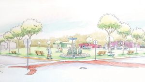
To do this, the plan calls for open spaces, bike trails and parks, along with incentives for denser development that doesn’t sprawl.
Ajans said she supports development and knows it’s coming. But, she also wants the land to serve the community on several different levels. She said there has to be a balance between development and green areas.
“I have no problem if you cut down trees for development,” she said, “but we need to plan and replace the things we cut down.”
Without any surefire ways to protect rural land, it’s unlikely that much of the area’s rural atmosphere will remain in 10 to 20 years, Barrow said. Conservation easements are one option. The city can already create these but rarely does. To create this easement, the city could buy a property’s usage rights and then restrict the development that’s allowed there.
Another option, called transfer of development rights, would let people in a low-density area sell their rights to develop their own land. Whoever bought these rights could then use them to add more density to a development that’s already in a high-density area.
Barrow said this is done in other communities around the nation, but it would take action by the state legislature to setup such a system in Missouri.
Without these and other measures, Barrow said it will be “extremely difficult” to keep the area rural.
“By little nicks and cuts, small little scratches, that land will be converted to the type of people who are going to maximize their profit by developing it to the max,” he said. “It’s not that anyone’s doing it on purpose; it’s just how the system is setup.”
For now though, the “For Sale” sign rests against the gate in front of Davis’ century-old blacksmith shop. She doesn’t expect any offers before the school is finished in three years, but she’s confident they will come.
“About everybody is resigned to the fact that development is going to happen,” she said. “So it might as well be planned.”
Construction bidding process continues
DLR Group is the main contractor for the high school building project. Other companies already involved, according to Columbia Public Schools spokeswoman Michelle Baumstark, include: • J.E. Dunn Construction
• Simon Oswald Associations, an architectural firm in Columbia
• Engineering Surveys and Services of Columbia
• Phillips Grading
The School Board plans to meet on Aug. 3 to vote on 48 bid projects, in which there are 234 individual bids. The $75 million project is already over budget by about $7.8 million, according to newspaper reports. Part of this cost is related to the $2.9 million road project running alongside the school’s western boundary.